GeogrAPHY OF ALBANIA
This is a Google Maps view of Tirana, Ablania. Otherwise known as Albania's capital.
Sources of info:
http://www.nationmaster.com/country-info/stats/Geography/Elevation-extremes/Highest-point http://geography.about.com/library/cia/blcalbania.htm |
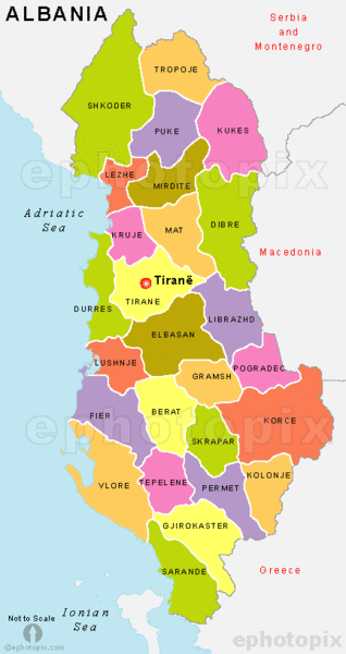
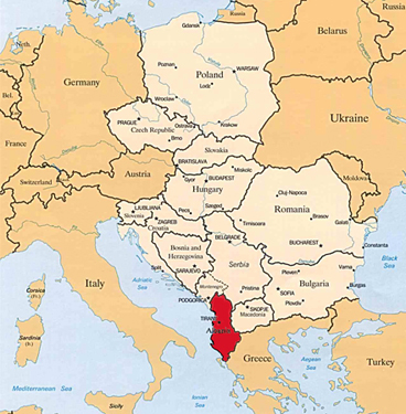
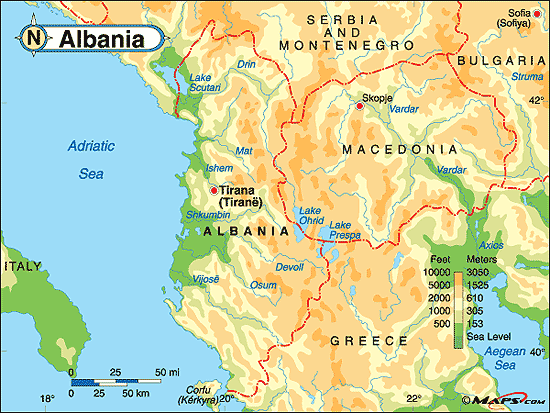
The maps above our Physical, and Region maps of Albania. Albania is located at 41 degrees North and 20 degrees East. The total area of Albania is 28,748 sq km. The land area is 27,398 sq km, and the water area is 1,350 sq km. Albania is slightly smaller that Maryland, United States. Albania is the 147th in size ranking of all countries. Greece (282 km), Macedonia (151 km), Serbia and Montenegro (287 km) share a border with Albania (Total area of border shared=720). The coastline of Albania is 362 km. Albania's climate is cool, and cloudy, wet winters (mild temp.), and hot, dry, clear summers. The inner part of the country is cooler and wetter. Albania has a mountain and hilly terrain with plains along the coast. The lowest elevation of the country is the Adriatic Sea at 0 m, and the highest is Maja e Korabit (Golem Korab) 2,764 m. Natural disasters that may occur in Albania are Drought, Earthquakes,and floods but none seem to occur very often. Some environment issues in Albania are deforestation, soil erosion, and water pollution.
|
|
